River Radar - JMR-611 Series
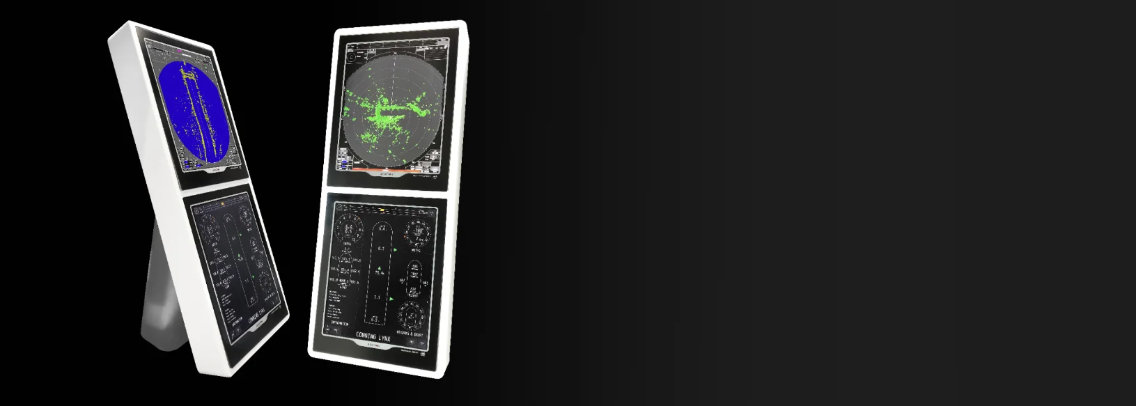
The JMR-611 river radar, developed by JRC | Alphatron Marine, signifies the next generation in radar technology. This radar is recognized for its unmatched wave suppression on open water (provided a JRC GPS compass is connected) and an outstanding user interface. With options for either a standard monitor or a fully glass monitor, the JMR-611 series offers a fresh perspective on navigation equipment. The aerodynamic scanner and motor make this radar particularly well-suited for extreme weather conditions.
With over 1,000 installed river radars, we provide reliable navigation solutions that meet the demands of experienced skippers. For more information about our advanced technologies and how they can enhance your navigation, we are here to assist you. Experience it yourself and contact us via phone o e-mail.
Technical Documentation and Manuals
For additional technical documentation related to the JMR-611 radar, such as manuals, brochures, and more, you can find it here.
Sea State function
The JMR-611 radar represents a groundbreaking innovation for inland navigation by being the first river radar to utilize a combination of a connected JRC GPS compass and intelligent calculations to minimize disruptive wave action on open water. The unique Sea State function resulting from this is invaluable for vessels operating regularly on expansive waters. By connecting a JRC GPS compass, the radar can utilize its full functionality, including AIS display, prediction lines, docking assistance, and the RTH-up function.
Traditional radar systems often struggle to distinguish small echoes amid waves, complicating navigation and increasing the risk of accidents. However, thanks to the integrated Sea State function, the JMR-611 radar can reduce wave action while still accurately detecting even the smallest details. This provides inland navigation skippers with better visibility and greater control over their surroundings, significantly enhancing the safety and efficiency of their journeys.
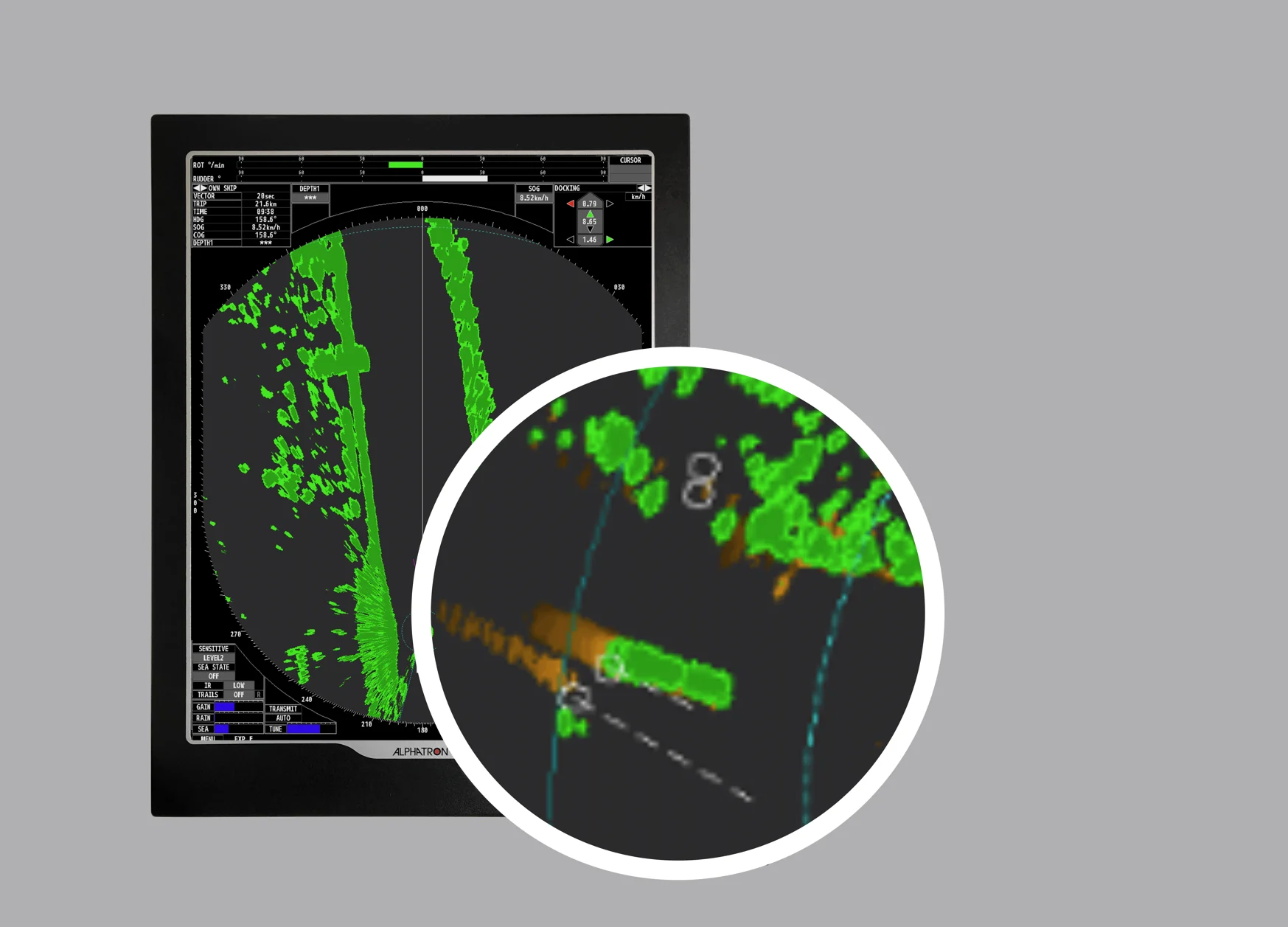
Wake Trails
By linking the JMR-611 radar to a GPS compass, we can reduce the impact of wake trails while accurately tracking the true movements of vessels. Traditional raster-scan radars are known for mixing real and false echoes due to wake trails, especially when vessels are moving quickly past. This can make estimating their navigational routes difficult or even impossible. However, by integrating the JMR-611 with a GPS compass, we can mitigate these wake trails and achieve a clearer and more accurate image of surrounding vessels. This not only enhances awareness but also enables us to better identify and track objects without AIS. In short, pairing the JMR-611 radar with a JRC GPS compass provides an excellent opportunity to enhance radar effectiveness and improve navigation on open water.
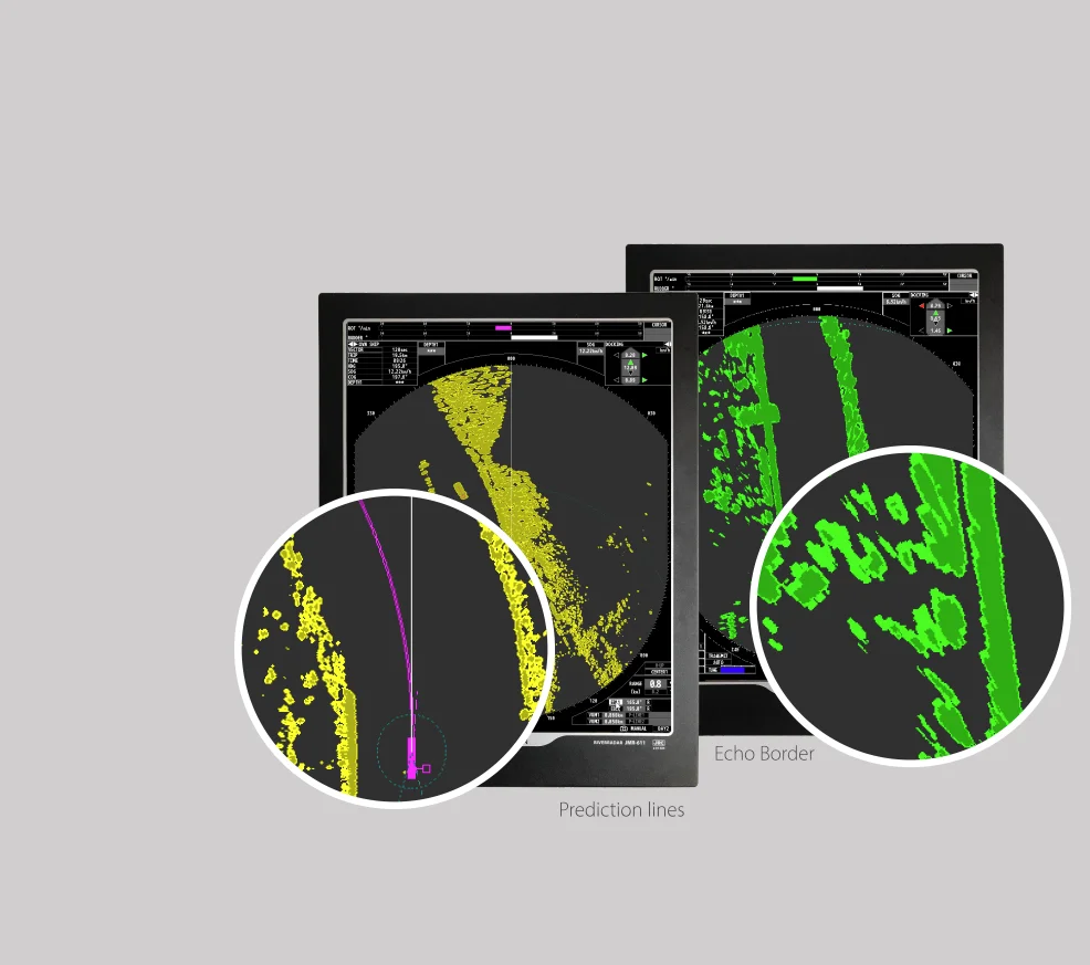
Echo Border and Prediction Lines
To present radar echoes more clearly, the radar is equipped with the Echo Border function. This feature ensures that echoes are displayed with a sharp, well-defined outline. When combined with the Expansion function, the visibility of echoes is further enhanced by clearly marking them. This results in a more accurate and easily interpretable radar image, promoting safety and efficiency in navigation on board.
Prediction Lines
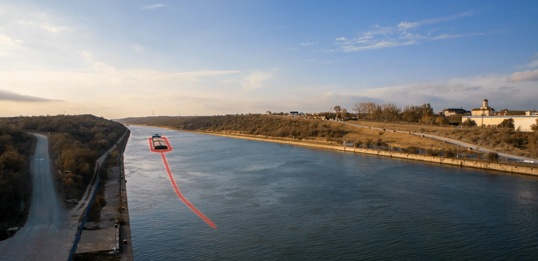
The unique docking and prediction lines, initially introduced with the JMA-609 radar, have further evolved and improved with the JMR-611 radar. Thanks to advanced calculations, two stable lines from the bow and stern are now displayed. These lines, also known as vectors, indicate where the vessel will be located over a specified time that can be set as desired. This functionality is available when a GPS compass or two GPS antennas (one at the front and one at the back of the vessel) are installed. This provides skippers with even more precision and insight during docking and maneuvering, enhancing the safety and efficiency of the docking process.
Enlarged Radar Image
By smartly utilizing the available space on the 19-inch monitor, maximum space is used for displaying radar echoes. Furthermore, the radar image can be enlarged even further by closing both conning windows at the top of the screen. This makes the radar image more prominent and easier to see, giving the operator a better overview of the environment and potential obstacles. This function maximizes the effectiveness of the radar and contributes to safe and efficient navigation.
User Settings
To maintain an overview for different users of the JMR-611, the system offers the ability to create multiple user profiles. This allows users to save their personal settings, making it easy to revert the radar to their desired configuration. This feature is particularly handy given the extensive capabilities of the radar, enabling users to quickly and easily switch between different preferences and work situations.
Conning Information
At the top of the screen, there is optional space available for displaying conning information, which is essential for navigating the vessel. This information can include: docking, wind meter, echo sounder (2x), and AIS. In conjunction with the AlphaPilot MF, the selected mode (W.A. or autopilot) is also clearly displayed at the top of the screen. For users who are only interested in radar information, virtually all extra functions can be easily turned off, providing a more streamlined and customized user experience.
Photoshot
With just one press of a button, the current radar images and relevant information such as course indications, speed, and AIS data are accurately captured on a CF card. This card can easily be transferred to a computer for evaluation or as evidence. With this feature, you can effortlessly document and capture important moments for later analysis or reference.

Scanner unit
Depending on the available space on board and the required performance, different scanner units are available in sizes of 6, 7, or 9 ft. All antennas have an aerodynamic design suitable for all weather conditions. For fast-moving vessels, the rotation speed of the antenna can be easily switched to a higher speed. This feature is only available for 6 and 7-foot antennas.
Seamless Integration and Flexible Connection
Thanks to the radar's network connection (LAN), a correct and stable operation is guaranteed for displaying the radar image on a radar overlay system, such as the RadarPilot720 and AlphaChartOverlay. Moreover, the JMR-611 can be connected to almost any existing radar cable due to the minimal number of wires between the scanner and processor unit, which is particularly convenient in situations where replacing the radar cable poses a significant challenge.
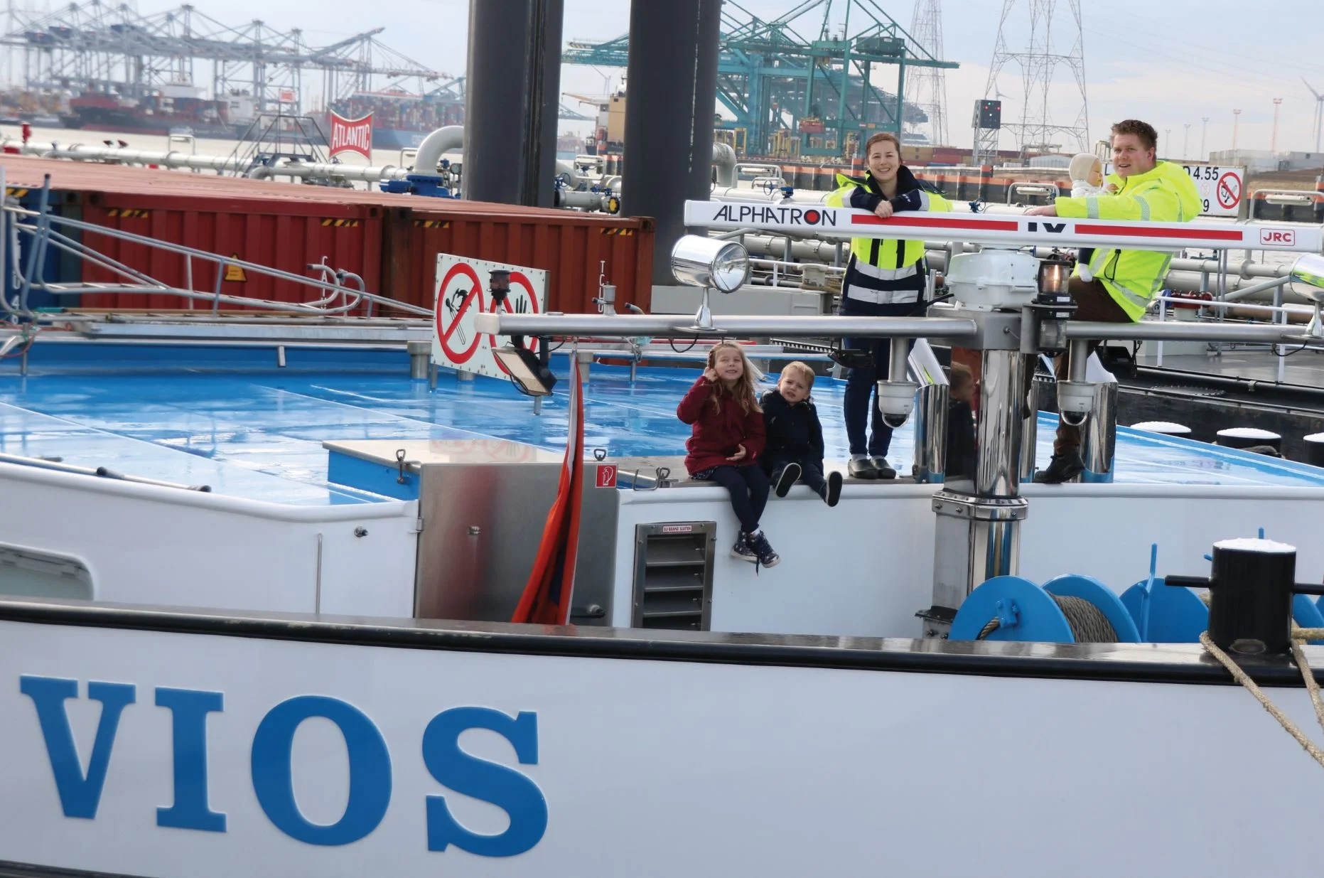
1.000 others have gone before you! “Not a second of regret”
The JMR-611 is the preferred river radar for many shipping companies and captains in the inland navigation market, including Pascal Kuipers, captain of the container ship MS Vios. His decision to switch to this radar was driven by his concern for safety. The improved mooring and prediction lines, along with the advanced calculation technology on the new river radar, provide an accurate indication of the ship's position at all times. This is especially crucial when navigating busy routes, such as those between Antwerp and Ghent.
A standout feature that distinguishes the JMR-611 is the Sea State function, which ensures that buoys and small echoes remain clearly visible even under extreme weather conditions, such as strong winds. Furthermore, the choice of two scanners—one large at the front for sharper images on rivers, and a smaller one at the back for better clarity during storms—emphasizes the commitment to safety in all weather conditions.
Pascal Kuipers, who replaced his old radar with the JMR-611, stated: "I have not regretted it for a second." Kuipers, who grew up on an inland vessel and has been sailing for many years, underscores the importance of this radar for the safety of his ship, especially given the challenging routes he navigates daily.


